
The Sataf hiking trail is one of the most interesting short walks west of Jerusalem because the landscape explains how people once farmed steep hillsides. Stone terraces hold orchards and vegetable plots above the Sorek valley. Two springs—Ein Sataf and Ein Bikura—feed old irrigation channels. The restored water system gives the walk a story beyond the views.
Quick answer: Sataf has several marked route options, not one fixed circular trail. KKL-JNF describes a Village Track of roughly 2 km and a Dryland Farming Track of roughly 3 km, both generally running downhill from the upper parking area toward the lower area. Shorter or circular variants are possible from the middle parking area, but the exact length depends on the signed return route. A lower Sorek trail section is currently closed; do not rely on an old map. Official Sataf route guide.
Sataf trail facts at a glance
| Question | Practical answer |
|---|---|
| Where is it? | Sataf Forest, on the western outskirts of Jerusalem, above Nahal Sorek |
| Entrance fee | Free to enter the KKL-JNF forest and Sataf site |
| Main marked routes | Green Village Track (~2 km); blue Dryland Farming Track (~3 km) |
| Is it circular? | Not by default. Official main descriptions run between different parking areas |
| Start / finish | Usually upper car park → lower car park; middle car park offers alternatives |
| Difficulty | Uneven steps and steep hillsides; conditions can be slippery |
| Springs | Ein Sataf and Ein Bikura; irrigation and heritage features, not drinking or swimming sites |
| Facilities | Upper-area lookout, drinking water, toilets and information; verify current opening hours |
| Best time | Mild, dry daylight hours, often autumn to spring; avoid wet and very hot conditions |
| Current restrictions | Closed Sorek section toward the water-treatment facility and other temporary detours |
Source: KKL-JNF Sataf site, KKL-JNF Sataf Forest notices (Hebrew) and tourist alerts, checked 3 November 2026.
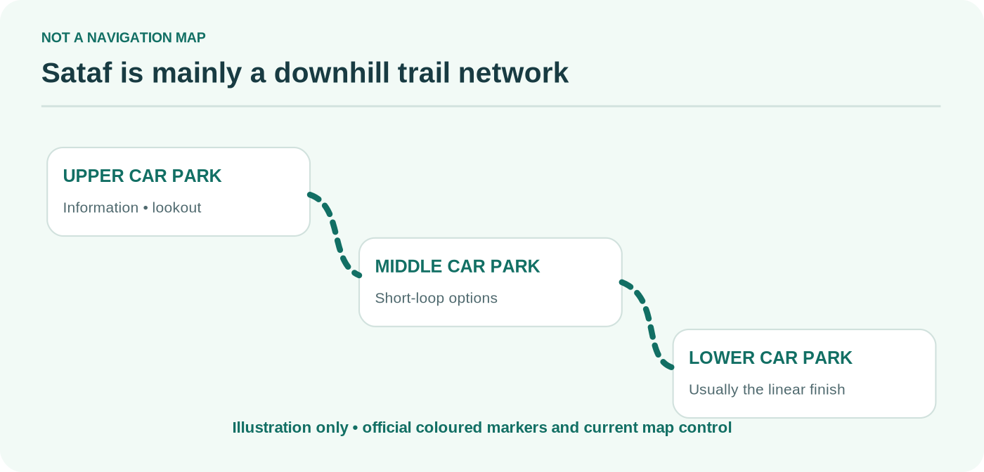
Where to start: upper, middle or lower parking area?
Sataf has three parking areas, each serving a different purpose. Choosing one is the single most useful planning decision you can make before visiting.
Upper parking area: the standard starting point
The upper car park has the clearest orientation for a first visit. KKL-JNF describes an information point, picnic space, drinking-water facilities, toilets and a short accessible viewpoint with views toward the hills and the Sorek valley. The marked walks begin from this upper area and generally descend through the old agricultural landscape.
The facilities are not open around the clock. According to the KKL-JNF Sataf Forest page, the visitor information point lists summer and winter hours, with the toilets tied to café opening. Check those hours on the day; do not plan a late-afternoon hike around an assumed open restroom.
Middle parking area: useful for a shorter visit
The middle parking area is a smaller private-car lot. It can make a shorter circuit possible when used with signed connections, but you still need the current site map. A route described online as a “Sataf circular trail” may start here rather than at the upper car park. That difference changes how much climbing is required on the return.
For visitors with limited time or mixed walking abilities, confirm with staff or signage which signed circuit is suitable that day. The middle area does not turn every route into a fully accessible walk.
Lower parking area: a finish, not always an easy return
The lower car park lies near Nahal Sorek. It is a natural endpoint for the official descending tracks. Ending here is convenient only when someone can collect you, you have a verified return arrangement, or you deliberately plan a signed uphill return route.
The KKL-JNF 2026 update states that buses may no longer use the road descending from the upper parking area; they can wait at designated other locations, including the lower area. This affects group trips and private transfers. A walking party that assumes the minibus can simply collect them at any car park may be disappointed.


Two official hiking routes at Sataf
Option 1: Village Track — approximately 2 km
The green-marked Village Track focuses on the settlement landscape, orchards, terraces and spring-fed farming. KKL-JNF gives about 2 km from the upper car park to the lower car park, along green markers and sections associated with the Israel Trail. The route involves steps and uneven ground and loses elevation rather than forming a simple flat loop.
The main appeal is being able to see water and farming systems together. The path passes through a landscape where tree crops and cultivated beds are supported by channels that distribute spring water. The terraces are not decorative walls: they make steep farming possible by holding the soil in place.
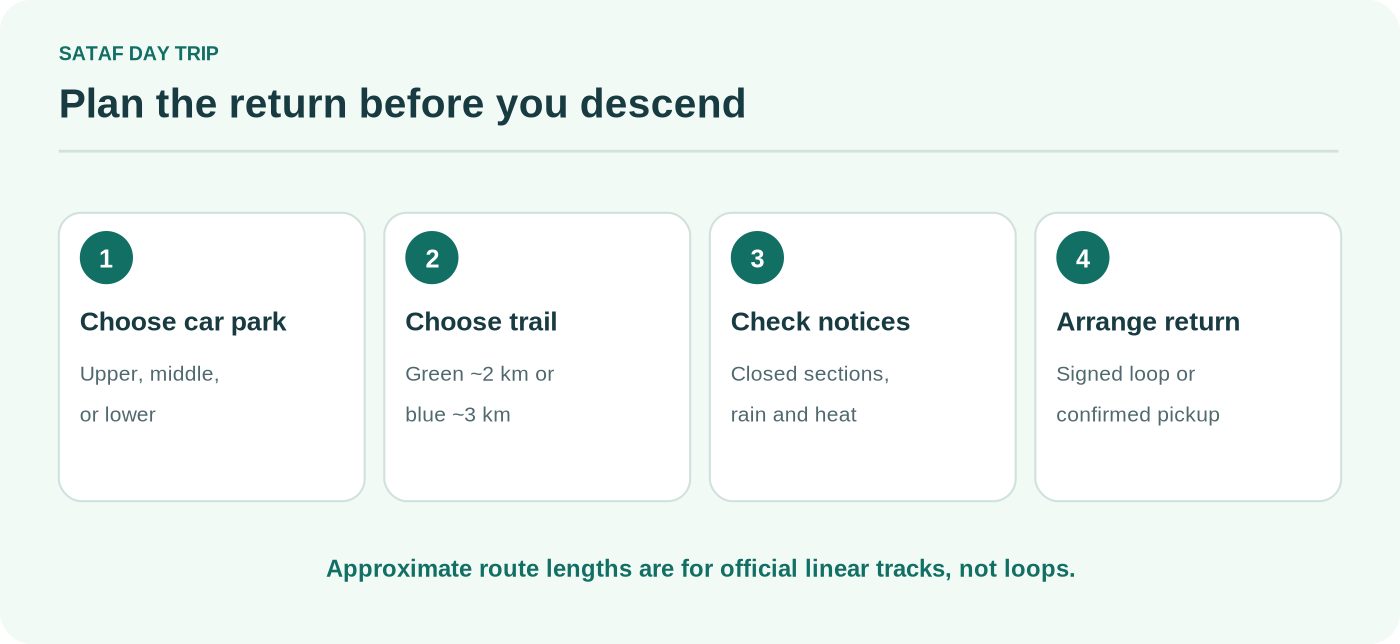
If you intend to return to the start, decide which signed trail you will use for the climb back before descending. Do not calculate your day as “2 km total” unless your transport genuinely finishes at the lower parking area.
Option 2: Dryland Farming Track — approximately 3 km
The Dryland Farming Track, marked in blue, takes a different emphasis: growing crops on hillsides without relying on constant spring irrigation. KKL-JNF describes it as roughly 3 km, generally descending from the upper to lower parking area. Along the way are old agricultural features, including stone structures and cultivated slopes.
This route is not simply a longer version of the same spring walk. Some visitors will prefer it for the broader landscape and different agricultural story; others who mainly want to see the springs may find the Village Track more direct. KKL-JNF mentions alternative loops using the middle car park, but a route drawn as circular has its own length and climb. Consult the official path descriptions rather than transferring the 3 km figure to a new loop.
| If your priority is… | Consider | Be aware |
|---|---|---|
| Springs and historic irrigated terraces | Village Track | Approx. 2 km one-way downhill |
| Dry-farming terraces and a longer landscape walk | Dryland Farming Track | Approx. 3 km one-way downhill |
| Less walking from a car | Middle-car-park alternative | Verify the signed loop and current distance |
| Avoiding a return climb | Linear descent with pickup | Arrange the pickup before setting off |
Ein Sataf and Ein Bikura: what the springs actually are
At Sataf, water emerges from the hillside and has long been collected and guided through channels to cultivated plots. The site’s two main springs, Ein Sataf and Ein Bikura, make the historical system tangible. Terraces, irrigation channels and orchards sit close enough together that you can understand how a community worked with limited water on sloping ground.
This is not a swimming stop. KKL-JNF explicitly prohibits drinking from, swimming in or jumping into the spring pools and channels. Some old channels and aqueducts are dark or wet. KKL-JNF advises a flashlight and suitable water-walking footwear for particular aqueduct visits, but entering them should never be assumed safe or essential to the day. If conditions or access rules are unclear, enjoy the site from the permitted outside viewing areas.
Keep off agricultural beds and do not climb retaining walls. Restored terraces are working conservation features. Photographing them from the path is more useful than stepping into plots to get a close-up shot.


Sataf trail map and closures: what to check in 2026
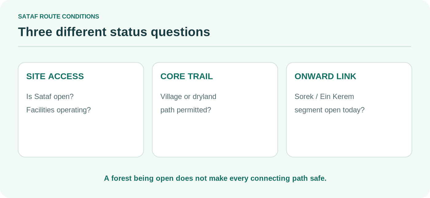
A screenshot of a trail map is useful only if it is current. The Sataf area connects to Nahal Sorek, the Israel Trail and longer hill paths. Closure notices can affect those connections without closing the whole Sataf visitor area.
The KKL-JNF 2026 Sataf Forest update explains that maintenance work has changed parts of the Israel Trail alignment around the Sorek corridor. It also describes a temporary rerouting in the direction of Ein Kerem. Separate tourist notices state that the Nahal Sorek section from the lower Sataf car park toward the water-treatment facility is closed due to hazards.
Do not try to connect the basic Sataf springs walk to Ein Kerem by improvising through a closed stream section. Obtain the latest marked-map version from KKL-JNF, follow on-site barriers and local instructions, and change plans if an intended extension is not available. Forest-wide reopening notices do not override a site-specific prohibition.
Is the trail open right now?
This article records source status as checked on 3 November 2026. It does not provide live gate or trail clearance. Conditions may change with rain, fire damage, maintenance or a security incident. Ask the site operator about the exact path—not just whether “Sataf is open.”
How to get to Sataf from Jerusalem
By car or taxi
The forest is reached from Road 395, near the Sataf junction west of Ein Kerem, with paved access to the parking areas. Search specifically for “Sataf – upper parking” or the correct car park for your route rather than the general place name. The KKL-JNF forest page describes access from the Sataf junction and the Ein Kerem side.
If using a taxi, agree on the exact pickup car park in advance. Mobile reception and available cars should not be assumed at the end of a hillside walk. The upper area is a different endpoint from the lower car park; sending a driver the generic “Sataf” pin can create an unnecessary return climb.
By public transport
Public transport may reach settlements or roads in the region, but that does not establish a convenient active service to each Sataf car park. Check the precise date and stop in a current Israeli route planner, then check whether the final approach is safe and practical on foot. Shabbat and holiday schedules can be especially limited. Avoid inventing a direct bus connection that may not exist for your departure date.
For wider train and bus planning, use our getting around Israel without a car guide. The key local decision is still how you reach the start and leave the finish.
When to visit and what to bring
Cooler autumn, winter and spring days can make the terraces more comfortable to walk, while seasonal plants change the hillsides. But rain makes polished stone, wet channels and limestone steps slippery. In summer, start early, bring more water and avoid the hottest hours. A signed short trail does not provide dependable shade throughout.
For a typical daylight visit, bring:
- Closed walking shoes with grip for stone and gravel, rather than smooth-soled sandals.
- Your own drinking water; the springs are not potable drinking-water sources.
- Sun protection and an extra layer in changeable weather.
- A current marked route map saved offline, plus a charged phone.
- A confirmed pickup or return plan if you follow a linear route.
- A small rubbish bag so nothing is left in or around the orchards.
Do not start a route when the remaining daylight is shorter than the walking time plus a margin for navigation and an unexpectedly slow section. Ask local authorities before entering tunnels or water channels; skip them when uncertain.
A simple two-hour visit plan
A short visit can focus on the upper lookout, an appropriate signed descent toward the main terraces and a planned return. The two-hour figure is a planning allowance, not a promise that a 2 km linear walk plus an uphill return always takes two hours. Group speed, stops and the chosen parking lot change the result. If you have no transport at the lower car park, choose a shorter signed return rather than forcing the entire linear route.
Sataf visitor rules worth knowing
KKL-JNF’s published rules are specific: no overnight stays or fires at the springs, no swimming, no drinking the spring water, no entry to cultivated fields and no unapproved amplified events. The trails cross steep mountain terrain; keep to marked paths. During wet conditions, reconsider the hike rather than treating ancient steps as secure modern stairways.
Broader security guidance also matters. The U.S. State Department’s 23 October 2026 advisory is Level 3: Reconsider Travel for Israel. Follow current official emergency instructions; an open nature site is not proof that regional conditions are unchanged.
Frequently asked questions
How long is the Sataf hiking trail?
There is no single Sataf trail length. The official Village Track is about 2 km and the Dryland Farming Track about 3 km, both described primarily as linear descents from the upper toward lower parking area. A circular or partial alternative changes the distance and climb.
Is the Sataf hiking trail circular?
Not by default. The main KKL-JNF descriptions are linear. A shorter loop can be planned with signed connections, particularly via the middle car park, but the route and distance must be checked on the current official map.
Can you swim in the Sataf springs?
No. KKL-JNF prohibits swimming, jumping and drinking from the spring pools or channels. Treat the springs as conserved historical water infrastructure, not bathing pools.
Is there an entrance fee at Sataf?
Entrance to Sataf Forest is free under the current KKL-JNF site information. Transport, guided activities or incidental services may cost extra.
Is Sataf suitable for children or beginners?
Some shorter, appropriately signed sections can suit families who are comfortable on uneven ground, but the full official descending routes include steps and steep paths. The upper viewpoint is a better starting point for visitors with mobility constraints. Check accessibility directly with the site operator; it is not accurate to describe all Sataf routes as accessible.
Can you walk from Sataf to Ein Kerem?
Not safely by assuming the old Sorek path is open. Parts of the corridor and connecting routes are subject to closures and rerouting. Use the latest KKL-JNF notice and signed map, and do not cross barriers. If a connection is closed, travel by an approved alternative route or transport.