
The best hiking trails near Jerusalem are not all in the same landscape. To the west, woodland paths cross old agricultural terraces, ridgelines and seasonal wildflowers. Closer to the city, forest tracks make shorter outings possible. East of Jerusalem, the terrain changes sharply to desert ravines where access and safety rules require much more care.
Quick answer: Choose Sataf for springs and terraces, Mount Eitan for a long panoramic loop, Jerusalem Forest’s Cedar Trail for a manageable woodland walk, or Ein Hemed for a gentler park visit. The Aminadav Springs Trail, Nahal Halilim and Martyrs’ Forest suit walkers who can plan a linear route and a return pickup. Check official trail notices before leaving: sections near Sataf and Ein Hindak are closed as of this review. KKL-JNF notices.
Hiking near Jerusalem: trails at a glance
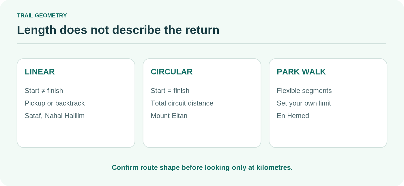
Distances refer to specific route options, not the size of the park. “Linear” means the start and end differ. Terrain and conditions can make a short route harder than its length suggests.
| Trail | Official route length | Effort | Start / access | Main appeal | Important condition |
|---|---|---|---|---|---|
| Sataf Village Track | About 2 km, linear | Moderate; steep descent | Sataf upper car park; pickup at lower car park | Stone terraces, orchards, springs | No swimming or drinking spring water; check partial Sorek closure |
| Mount Eitan loop | About 8 km, circular | Moderate–strenuous | Mount Eitan/Sataf area | Open ridge views and sustained walking | Shared with cyclists; exposed in places |
| Jerusalem Forest Cedar Trail | 2–3 hours; length not consistently published | Easy route listing; check terrain | Ontario Recreation Area near Yad Vashem | Shaded forest close to the city | Do not assume every forest path is accessible |
| Aminadav Springs Trail | About 3 km, linear | Moderate | Se’adim Ruins area; arrange end pickup | Spring-fed terraces and woodland | Ein Hindak is closed; do not continue into the closed site |
| Nahal Halilim | Roughly 3 km, linear | Easy–moderate; downhill | Mevaseret Zion toward Emek Arazim | Limestone valley and cave scenery | Slippery after rain; cave entry is optional |
| Martyrs’ Trail | About 2 km, linear | Moderate due to descent | Scroll of Fire Memorial | Woodland and memorial landscape | Steep continuation toward Martyrs’ Cave is a different hike |
| Ein Hemed park walk | Short walk; choose a park loop on arrival | Easy | En Hemed National Park | Streamside lawns and Crusader ruins | Ticketed park; seasonal opening hours |
Sources: Sataf (KKL-JNF); Mount Eitan route (Society for the Protection of Nature); Cedar Trail (KKL-JNF); Aminadav (KKL-JNF); Nahal Halilim (Ministry of Education); Martyrs’ Forest (KKL-JNF); Ein Hemed (INPA).
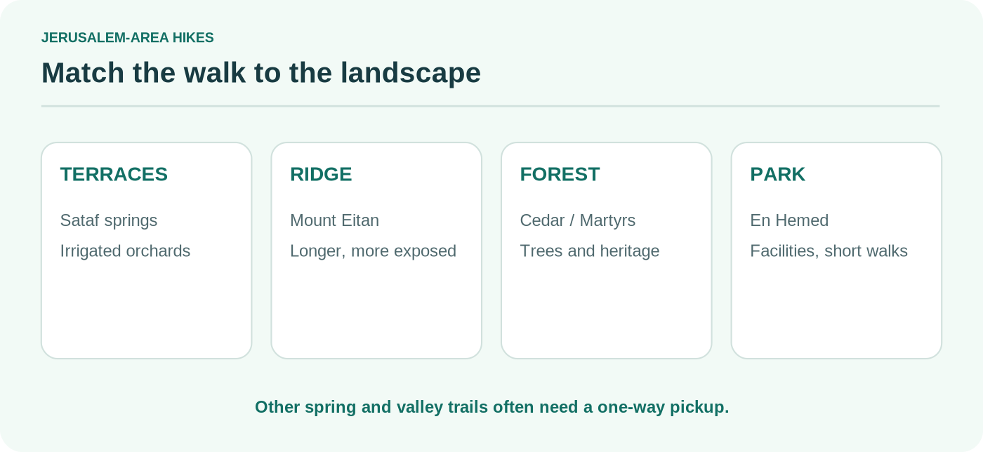
1. Sataf: springs, orchards and ancient terraces
Sataf is a strong first choice if you want more than a walk through trees. Old irrigation channels lead between cultivated terraces and natural springs. The official Village Track begins at the upper car park and descends about 2 km toward the lower parking area. It is not a two-kilometre circular walk. Reaching your original car can require another signed return path or a planned pickup.
The KKL-JNF site guide also describes a separate 3 km Dryland Farming Track, likewise mainly linear. Its blue markers and focus on rain-fed agriculture make it a different walk, not a shortcut around the springs. Stone steps and steep slopes can be slippery in rain.
Bring drinking water: the springs are not drinking or swimming pools. The Nahal Sorek section from Sataf’s lower car park toward the water-treatment facility is closed under the current KKL-JNF notice. Do not extend a downloaded GPX file into that section. See our dedicated Sataf guide for parking choices, the two official paths and the return-leg decision.


2. Mount Eitan: an eight-kilometre ridgeline circuit
For a longer outing, the Mount Eitan loop trades spring stops for far-reaching views. The Society for the Protection of Nature describes an approximately 8 km circular route, on a red-marked track used for walking and mountain biking. It circles the mountain and looks across the Jerusalem Hills and the Sorek valley.
This is not the right route for someone hoping for a flat hour-long stroll. Even where the path is a broad track, the elevation, sun and length matter. Carry water from the start, watch for cyclists on bends and check whether fire-related works or temporary restrictions affect the area. The KKL-JNF Mount Eitan page confirms the loop is near its camping area.
A useful plan is to choose either Mount Eitan or the central Sataf springs, rather than assuming both can be squeezed into a short morning. They share an access region but ask for different amounts of time and energy.
3. Jerusalem Forest Cedar Trail: a nearby woodland option
If getting far outside the city is difficult, consider the Cedar Trail (Shvil HaErez) in Jerusalem Forest. KKL-JNF lists it as an easy walking path taking approximately two to three hours, with access through the Ontario Recreation Area near the Yad Vashem approach. This is a woodland trip; it does not include the indoor Yad Vashem visit.
Its proximity to city streets can create a misleading sense that every track is a safe shortcut. Use the official route description and an offline map. Leave time for the return to your starting point and avoid setting off late enough that the final wooded section would be in darkness. The forest guide warns against walking during the hottest part of the day.


4. Aminadav Springs Trail: green hills with one closed spring
The Springs Trail in Aminadav Forest runs about 3 km from the Se’adim Ruins area to an exit near the Even Sapir access road, according to KKL-JNF. It is described as moderate and typically requires a pickup. A return on a separate blue-marked section can make a circular outing, but this changes total distance and effort.
Terraces, old stonework and changing tree cover keep this path varied. The crucial distinction is between the marked Springs Trail and extensions to other water sites. Ein Hindak is explicitly closed because of a collapse hazard. Do not enter it, and do not follow older blogs claiming the spring is open. KKL-JNF’s current notifications take precedence.
A marked route is still not automatically suitable after heavy rain. If the forecast is unsettled, choose a park walk rather than forcing a spring-hopping itinerary across slick limestone.
5. Nahal Halilim: a valley descent near Mevaseret Zion
Nahal Halilim is a short valley walk from the Mevaseret Zion side toward Emek Arazim. The Israeli Ministry of Education’s route catalogue describes an easy route of around two hours, largely descending through open terrain, with a cave formation as its distinctive feature. Independent descriptions place the walk around 3 km; check the marked entry and exit used by your map before relying on that distance.
Caves are an optional stop, not an obligation. Entering wet or dark chambers without appropriate equipment and local confirmation can turn an otherwise straightforward valley walk into a poor decision. Expect exposed stretches, and take extra care after rain, when the official guidance highlights slippery surfaces. Since this is a point-to-point route, decide in advance how to leave the valley.
6. Martyrs’ Trail: a forest walk with memorial history
The Martyrs’ Trail, within the Forest of the Martyrs west of Jerusalem, begins near the Scroll of Fire Memorial and descends toward the Yemenite Jewry Forest recreation area. KKL-JNF describes it as an approximately 2 km one-way walk. Woodland, seasonal flowers and memorial stones shape the experience. The area commemorates Jewish communities destroyed during the Holocaust.
The path has a calmer feel than a busy park, but the short published distance hides an important detail: continuing from the recreation area toward Martyrs’ Cave involves a steeper additional descent. That is a separate choice for better-prepared walkers, not the natural end of an easy route. The KKL-JNF trail page advises arranging an end pickup for the basic linear walk.
Check forest status on the day. Broad park-reopening announcements should not be treated as approval for every forest road or mountain-bike singletrack.
7. Ein Hemed: a park walk instead of a full hike
En Hemed National Park, west of Jerusalem near Road 1, is the easiest option here for mixed-ability groups and visitors looking for a shorter nature stop. There are lawns, a shaded stream setting, picnic spots and Crusader-era ruins. This is better described as a park walk than an independent backcountry hike.
The Israel Nature and Parks Authority publishes summer and winter opening hours; the entrance gate closes before the park’s final closing time. Entrance is paid, unlike many KKL-JNF woodland sites. Check the latest fee and ticketing arrangement rather than assuming the price from an old review. Accessible features and trail suitability should be checked with the park before arriving.
How to choose: season, transport and difficulty
Jerusalem has a mild-looking map and demanding terrain. A path of only three kilometres may drop sharply; a longer but broad forest track may feel easier for some walkers. Base the choice on your knees, available daylight and return logistics—not solely on distance.
| Your situation | Sensible first choice | What to check |
|---|---|---|
| Want springs and historical terraces | Sataf Village Track | Which parking lot you finish at; current lower-path closure |
| Want one longer circular walk | Mount Eitan loop | Sun exposure, cycling traffic, forest notices |
| Have limited time near the city | Jerusalem Forest Cedar Trail | Actual trailhead and walking time |
| Prefer a calm park with facilities | En Hemed | Opening times, fee, accessibility |
| Want a one-way valley walk | Nahal Halilim | End pickup and rain conditions |
| Interested in heritage and woodland | Martyrs’ Trail | Steep optional extension and return |
| Want several springs | Aminadav Springs Trail | Closed Ein Hindak area; permitted signed route |
Getting to a trail without a car
Most of these are not city-centre-to-trailhead bus rides. A public bus may reach a neighbouring district without serving the official starting car park or the end of a linear walk. If relying on transit, check the exact date, direction and final connection in a current journey planner. On Shabbat and holidays, regular service may be limited or unavailable; prearrange a licensed taxi if necessary. See our transport guide for system-wide planning.
Safety and closures: check before you go
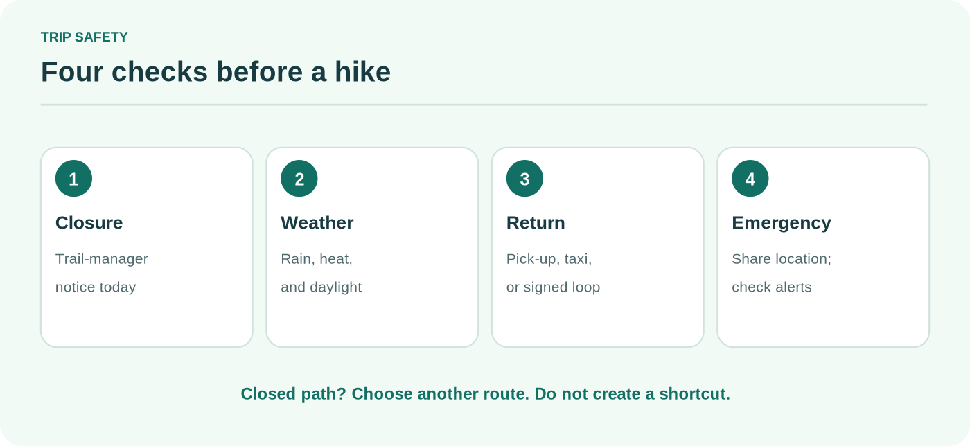
Before a hike, use four sources in order: (1) the trail manager, such as KKL-JNF notifications; (2) the latest INPA notices for national parks; (3) an up-to-date forecast and official emergency instructions; and (4) a reliable marked-trail map. Save offline directions, tell someone where you are going, carry enough drinking water, and finish well before sunset. Avoid caves, spring tunnels and unmarked shortcuts when conditions are uncertain.
International visitors should also review their own government’s travel advice. As of 23 October 2026, the U.S. State Department advises reconsidering travel to Israel because of terrorism and unrest. Site reopening does not cancel wider security considerations.
Frequently asked questions
What is the best short hike near Jerusalem?
For a short nature outing, look at Sataf’s signed sections or the Cedar Trail in Jerusalem Forest. Sataf’s official 2 km Village Track is linear and steep, while the Cedar Trail is described as an easy two-to-three-hour forest walk. Decide whether you need a circular route before setting out.
Are hiking trails near Jerusalem free?
Many KKL-JNF forest trails are free to enter, including Sataf. National parks such as En Hemed charge an entrance fee. Transport, parking, guided activities and equipment can still cost money.
Can you hike near Jerusalem on Shabbat?
Some open-air forest sites can be visited, subject to official closures and security rules. The challenge is often getting there and back without regular public transport. Check the specific trail and return journey; do not assume that a site with no admission gate has public buses running to it.
Is Ein Hindak open?
No. KKL-JNF lists Ein Hindak in Aminadav Forest as closed because of a collapse hazard. Do not follow older routes through that location. Check the source again before publication and before travel.
Can I hike Ein Prat from Jerusalem?
Ein Prat is a managed nature reserve east of Jerusalem, not an interchangeable add-on to these western woodland trails. It has its own opening hours, access rules and security considerations. Use our separate Ein Prat guide and confirm current permissions directly with the INPA before planning it.